Sumba Island, Indonesia: The Complete Travel Guide
By Blaise Jaeger · Updated August 10, 2026
Why Visit Sumba?
Sumba is one of those Indonesian islands that people hear about twice a year, usually because of a luxury resort or a photo of horsemen throwing spears, and then never quite place on a map. It sits in East Nusa Tenggara, in the Lesser Sunda chain of eastern Indonesia, south of Flores and Sumbawa, and it is reached by a single short flight from Bali. That flight is the reason Sumba still feels the way it does. There is no ferry crowd, no scooter convoy, no beach club. There is an island roughly twice the size of Bali, with about 800,000 inhabitants, a road network that ranges from decent to genuinely punishing, and a living ancestral culture that has not been rearranged for visitors.
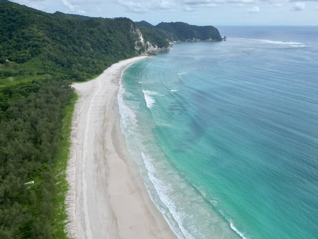
What makes Sumba worth the detour is the contrast you cross in a single trip. The east is savanna country, wide and dry and open, with herds grazing under a hard sky; in the rainy season those same slopes turn an absurd, saturated green that looks less like Indonesia than like the set of the Teletubbies. The west is the opposite, dense jungle folded over steep hills, wetter, greener year-round, and far more densely villaged. Between the two you drive past megalithic tombs standing in front yards, past thatched houses with towers rising out of their roofs, past men carrying a machete on the hip the way other people carry keys.
The other thing Sumba has in quantity is empty coastline. The south coast of the east, around Tarimbang, and the whole southwestern shore hold long beaches with real surf and, most days, nobody on them. This is not the polished, serviced emptiness of a private island; it is the ordinary emptiness of a place that never built the road properly. If you are used to Bali, or even to the quieter islands of the archipelago, Sumba will feel like a step further out, closer in spirit to Sumbawa or the inland parts of Flores than to anywhere with a beach bar.
It is also, honestly, a demanding island. Distances are short on paper and long in practice. Accommodation is thin outside the two towns with airports. You will spend real money on a driver because there is no comfortable alternative. In exchange you get a place where the culture on display is the culture people actually live in, and where you can stand on a ridge at six in the morning and watch wild horses move across it. That trade is the whole argument for going.
Sumba at a Glance
Before the details, here is the frame. If you only read one section of this guide before booking, read this one and the itinerary further down.
- Where is Sumba? In East Nusa Tenggara province, eastern Indonesia, in the Lesser Sunda Islands south of Flores and Sumbawa. It is a separate island from both, with its own airports and its own culture.
- Size: roughly 220 km long and 40 to 70 km wide — about twice the surface of Bali, which is the number that surprises most people.
- Population: around 800,000, spread thinly, with most of the density in the west.
- Airports: two. Waingapu in the east, Tambolaka in the west. Flying into one and out of the other is the single best decision you can make for this trip.
- Language: Bahasa Indonesia is the common tongue, spoken alongside several distinct Sumbanese languages that change from one district to the next. English is limited outside hotels and guides; a translation app earns its keep here.
- Season: the dry months run roughly April to October, the rains roughly November to March. Dry means easier roads and brown savanna; wet means green hills, heavier driving and the Pasola season.
- How long: seven to ten days for a proper east-to-west crossing. Five is possible and rushed. Less than that and you are paying for flights to sit in a car.
- Direction of travel: east to west. Land at Waingapu, work your way across, fly out of Tambolaka. The landscape gets progressively greener and the villages progressively denser, so the trip builds instead of deflating.
- Vehicle: a 4×4 with a driver, not a scooter and not a small rental car. On several stretches this is not a comfort choice, it is the difference between arriving and not arriving.
For the wider context of getting into the country, visas, and inter-island logistics, the Indonesia hub covers the parts that are not specific to Sumba. The official tourism board at Indonesia.travel is also useful for current entry formalities, and the Wikipedia entry on Sumba is a decent primer on the island’s geography and history.
My Crossing of Sumba, East to West
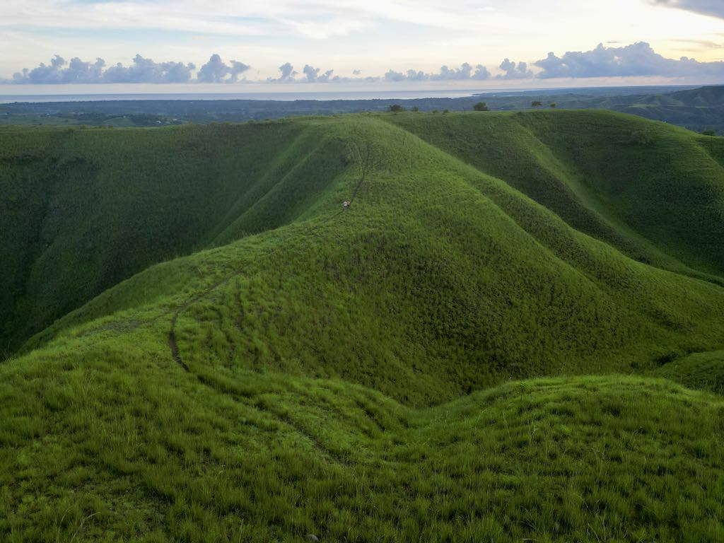
I crossed Sumba in March 2024, from east to west, landing at Waingapu and leaving from the other end of the island. March is the tail of the rainy season, which meant two things: the driving was slower than it would have been in August, and the east — normally dry savanna — was covered in that improbable green that everyone who has seen it ends up comparing to the Teletubbies. I would take that trade again.
The flight in was already a small lesson in where Sumba sits. Before Covid there were four flights a day between Bali and Waingapu. Today there is one. The schedule has not recovered, and it shapes everything downstream: fewer visitors, thinner accommodation, and a much stronger case for planning your dates around the flight rather than the other way round. If you are assembling a wider eastern Indonesia trip, it is worth reading how the pieces connect in the guide to getting to Indonesia before you commit.
Morinda, the hill above the river
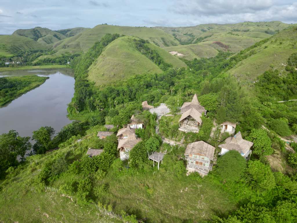
I based myself for the first nights at Morinda Villa and Resto, fifteen minutes south of Waingapu airport. They run a free shuttle, which removes the one genuinely annoying logistic of arriving on an island where taxis are not queueing outside the terminal. The property is perched on a hill above a river and ringed by very green hills, and it is at its best at the two ends of the day — sunrise and sunset both do something to that valley that a photograph only half captures.
One practical note from the same river: the hotel can arrange kayaking on it, and I would skip that. I strongly suspect there are a lot of crocodiles in that water. Nobody told me a story, and I am not reporting an incident — I simply looked at the river, at the mangrove edges further downstream, and decided the reward did not justify the question mark. Further along the coast, the mouth of the Kayouri river is openly described as crocodile habitat, which does not encourage a paddle.
The 5:30 AM walk, the wild horses and Batman
The hotel offers a walk in the surrounding hills that starts at 5:30 AM and finishes around 7:00 AM — a little over ninety minutes. Getting up for it is not obvious at the end of a travel day. Do it anyway. The light comes up sideways across the ridges, the temperature is still bearable, and on the crest line between two hills I ran into wild horses, which on Sumba is not a staged experience but simply what is there. I did the walk in the company of Batman, the owner’s dog, who clearly considers the route his. It is the single memory I would keep if I had to keep one from East Sumba.
That first morning also sets up the rest of the crossing. From Waingapu you go south and east to the tombs and the traditional villages, then south to the coast at Tarimbang, then west through Waikabubak, then out through Tambolaka. Each leg is longer than the map suggests. What follows is that route, in order.
East Sumba: Waingapu, Melolo and the Royal Tombs
Waingapu is the administrative and commercial centre of the east. It is not a charming town and it does not try to be — it is a port, a market, an airport and a grid of shops, and it is where you organise the rest of your trip. Treat it as a base rather than a destination. Everything worth your day is within one to two hours of it, along the coast road east and then south.
Walakiri beach and its trees in the water
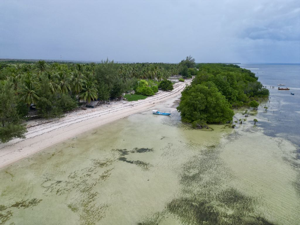
Walakiri is the closest thing East Sumba has to a signature image: a shallow, wide bay near Waingapu where small mangrove trees grow directly out of the water and stand isolated on the sand flats at low tide. Everyone photographs them, and everyone is right to. Beyond the photograph, it works well as a stop to eat something or drink a coconut in the middle of a driving day, which is how I used it. Go towards the end of the afternoon if you can; the light behind the trees is the entire point, and the tide has usually pulled back far enough to walk out among them.
Melolo and the village of Watu Hadang
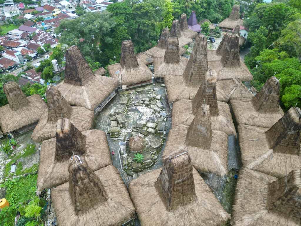
South-east of Waingapu, the road reaches Melolo, and just off it the traditional village of Watu Hadang. This is where the architecture of Sumba stops being a picture and becomes a system you can read. The houses are thatched, and each one carries a very high, very pointed central tower over the hearth. That tower is not decoration: it captures the hot air rising from the fire and the living space below and evacuates it, which is why the interior of a Sumbanese house is survivable in the middle of the day. The taller the peak, the better the draw.
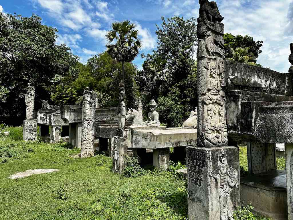
The second thing to notice is the doors. Each house has two entrances, and they are not interchangeable. The left-hand door is the family’s. The right-hand door is for visitors. Knowing which one to use before someone has to tell you is a small courtesy that changes the temperature of a village visit considerably. Facing the houses, and often only a few steps from the doorstep, stand the tombs — richly carved slabs of stone, buffalo horns, human and animal motifs, the dead installed squarely in the middle of daily life rather than fenced off at the edge of it.
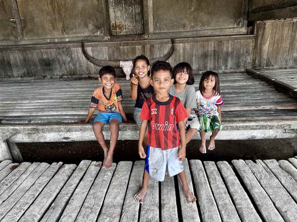
At Watu Hadang you can usually ask for a demonstration of thread dyeing — the plants and roots used to colour the yarn before it is woven, which is the first half of the ikat process and the half nobody photographs. It takes a few minutes, it costs the family something in time, and buying a piece afterwards is the natural way to close the loop.
Kampung Adat Praiyawang and the Kayouri river mouth
A short distance on, Kampung Adat Praiyawang holds the most imposing tombs I saw in the east. The scale changes completely: massive stone slabs, raised platforms, carving that took an enormous amount of collective labour to produce and move. These are the royal tombs of the local nobility, and they are the clearest physical argument that the pre-Christian social order of East Sumba was neither small nor improvised. You walk through a village that is still inhabited, past monuments that would be behind glass elsewhere.
The other stop on this stretch is the mouth of the Kayouri river, which is natural crocodile habitat. You go to look at it, from a distance, and that is the whole activity. It is a useful corrective to the idea that eastern Indonesia is one long swimmable coastline: on Sumba, river mouths and mangrove edges are not for swimming, and locals are entirely clear about which water is which. Ask before you go in anywhere that is not open surf beach.
For food and, if you want it, a bed on this side of the island, Amu Dahi is the address to know. I ate there and the local cooking was genuinely good — not the safe, flattened version served to visitors, but the real thing. It works for lunch, dinner, or a night if you would rather break the drive south instead of returning to Waingapu.
Tarimbang and the South Coast of East Sumba
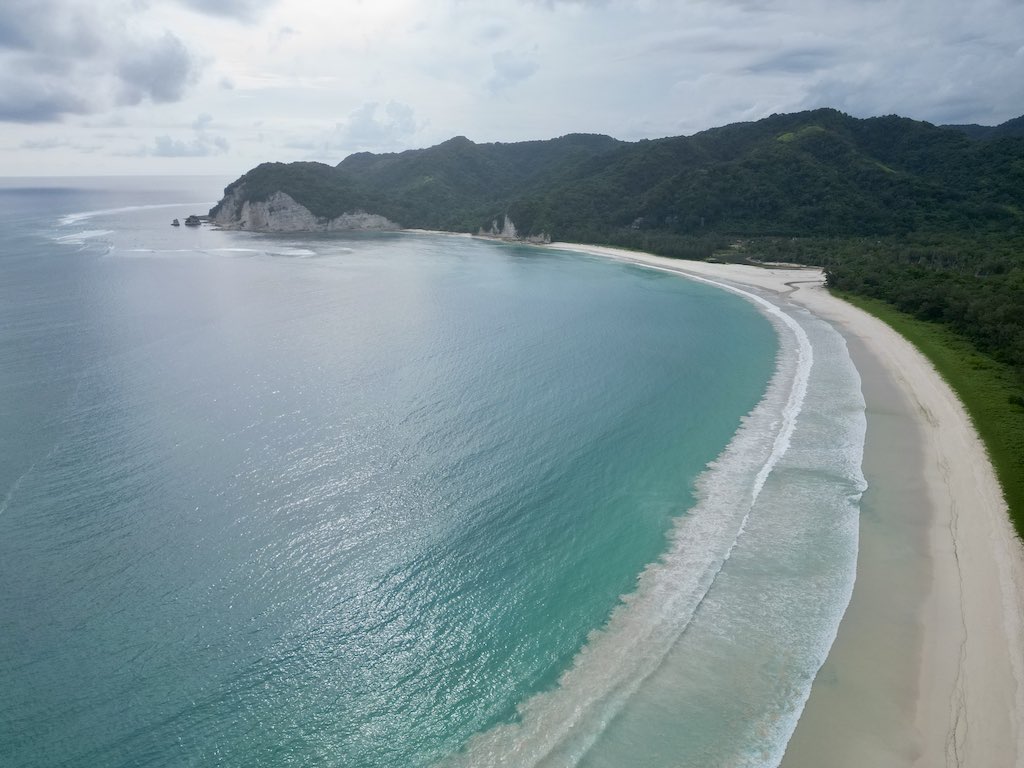
Tarimbang is the reason people who have been to Sumba get evasive when you ask them for their favourite beach. It is a long, wide bay on the south coast of the east, backed by hills, with real Indian Ocean swell, and on the day I was there it was absolutely deserted. Not quiet. Deserted. There are a handful of discreet eco-resorts tucked into the treeline, aimed almost entirely at surfers and spearfishermen, and a small sugar complex sitting up on a hill above the bay. That is the extent of the development.
The road to Tarimbang, and why you need a 4×4
You pay for Tarimbang in road. The last few dozen kilometres took me about three hours, and a 4×4 is not optional on that stretch — it is the vehicle the road was surveyed for, if it was surveyed at all. Coming down from Melolo, the approach is worse still. The surface alternates between broken tarmac, rutted dirt and stretches that are essentially a riverbed with ambitions, and in the rainy season the ruts hold water deep enough to hide what is underneath them.
The cautionary tale I heard on site and have repeated ever since: a Belgian traveller set off at 7:00 AM in a normal car and arrived at midnight. Seventeen hours. That is what happens when you take a low-clearance vehicle onto this road and then have to nurse it over every obstacle rather than drive over them. If your driver hesitates when you say Tarimbang, that hesitation is information — listen to it, and either change the vehicle or change the plan.
For anyone who was in eastern Indonesia a decade ago, the sensation is familiar. It reminded me exactly of the roads on Nusa Penida in 2015, before they were resurfaced — the same feeling of a place that is spectacular and simply has not been made easy yet. Penida is now paved and busy. Tarimbang is not, and that gap is precisely what you are buying.
Practically: leave early, do not plan anything else for that day, and if you are going to sleep down there, book it rather than improvising, because the choice is small and the drive back out in the dark is not something you want to do twice. Swim with respect for the swell — this is an exposed south-coast beach with no lifeguard, no phone signal worth the name, and no one else on it.
West Sumba: Waikabubak and the Traditional Villages
Waikabubak is the obligatory passage between east and west. Everything crossing the island funnels through it, and it makes a natural overnight stop that also happens to sit within a few minutes of some of the best-preserved traditional villages on Sumba. The change in atmosphere from the east is immediate. The hills close in, the vegetation thickens into real jungle, the villages come more frequently and sit higher, often on hilltops, clustered around their tombs.
Wailang, a village that is actually lived in
The traditional village I would send anyone to is Wailang. What distinguishes it is simple and it matters enormously: the uma mbatangu there are all inhabited. Not restored, not maintained as a demonstration, not opened at 9:00 AM for the coach. People live in them, cook in them, dry things on them, and receive you in the middle of that. It changes the entire register of the visit — you are a guest in a place of residence rather than a ticket-holder in an open-air museum.
One family proudly showed me the trophies their son had won in the Mister Sumba competitions, lined up inside a house whose roof structure has not changed in centuries. I liked that a great deal. It is the correct antidote to the idea that traditional villages are frozen: the building is ancestral, the household is contemporary, and both facts are true at once.
The architecture itself shifts as you move west. The roofs here are noticeably higher and sharper than in the east — the same principle of the hot-air tower, pushed further. Once you have seen an eastern village and then a western one, you can date-stamp your own photographs by the angle of the peak alone.
Waikabubak market and hand-woven ikat
The market at Waikabubak is worth an hour of anyone’s morning. Fresh produce, the ordinary commerce of a market town — and hand-woven ikat, which is the reason to go. Sumbanese ikat is among the most recognisable textile work in Indonesia, and the market is where you see it as a traded good rather than as a souvenir rack. Prices vary enormously with the fineness of the weave and the complexity of the pattern, and a genuinely handmade piece represents months of work by one person, which is worth remembering before you open with an aggressive counter-offer.
Buy at the source if you can — at a village where you have seen the dyeing done, or at the market rather than at an airport counter. It is the one purchase on Sumba where the money goes somewhere legible.
The Beaches of West Sumba
The southwestern coast is where Sumba’s reputation as a surf island comes from. A succession of bays cuts into the cliffs, most of them backed by hills rather than by any kind of development, most of them holding proper ocean swell. The water is clean, the sand is pale, and outside the handful of resorts there is very little infrastructure — no warungs strung along the sand, no rental umbrellas, frequently no signage telling you a beach exists at all.
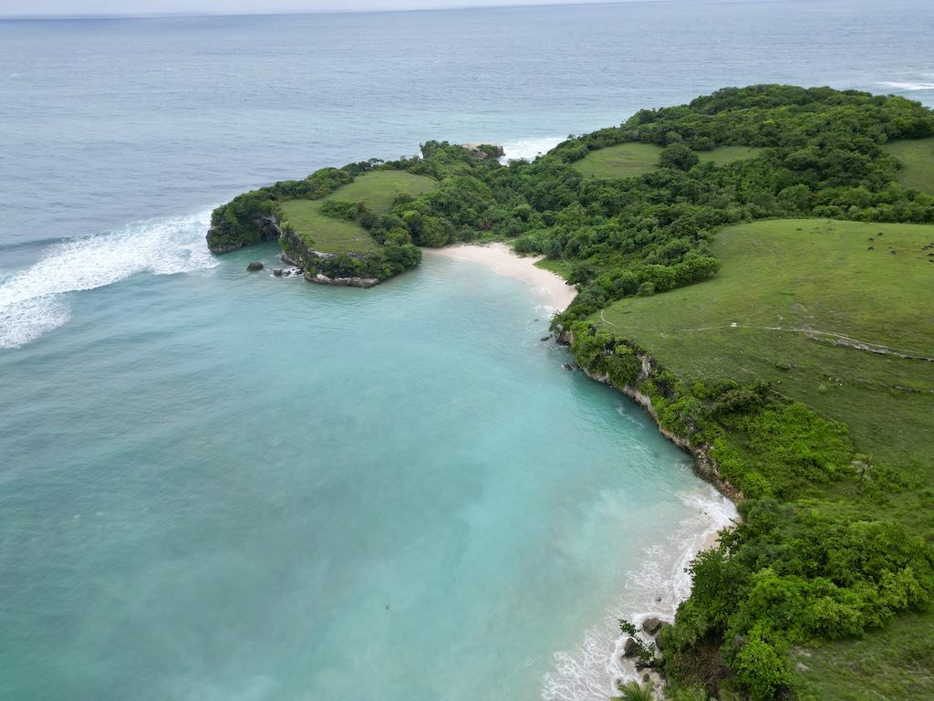
I spent two nights on this coast at the Sumba Surf Camp, in the same bay as the very exclusive Nihi, at a price that bears no relation to its neighbour’s. That proximity is the useful thing to understand about the southwest: the same wave, the same sand and the same sunset are accessible at two wildly different budgets, because the resort owns a stretch of shoreline, not the ocean in front of it. If you are here to surf rather than to be looked after, the modest option and the famous one are looking at the same horizon.
A word of caution that applies to the entire south coast, west and east alike. These are exposed Indian Ocean beaches. The shore break can be heavy, currents run along the bays, and there is no lifeguard anywhere. If you are not a confident ocean swimmer, treat most of these beaches as places to walk and photograph rather than places to swim, and ask at your accommodation which bay is safe on the day — the answer changes with the swell. Snorkelling is not really the point here either; for that, Indonesia has far better addresses, collected in the guide to the best diving in Indonesia.
What the west does offer, and the east does not, is density of scenery per kilometre driven. Between two beaches you will pass a hilltop village, a set of tombs, a stretch of jungle and a rice terrace, and the road, while narrow, is generally in better condition than the track down to Tarimbang. Plan short driving days and stop often; that is how this coast rewards you.
Tambolaka and the Northwest
Tambolaka is the island’s second airport town and the natural end point of an east-to-west crossing. It is also the base for the northwest corner, which holds several of the sites that dominate photographs of Sumba online. I did not get to those particular sites myself, so what follows separates clearly what I saw from what is simply on the map.
The Talasi cashew nut factory
The stop I would actually insist on around Tambolaka is the Talasi cashew nut factory. You can visit the whole process, from the harvest through to the finished product — the shelling, the sorting, the roasting, the packing — and it is far more interesting than “factory tour” makes it sound, because cashews are genuinely difficult to process and the sequence of operations explains, in about twenty minutes, why they cost what they cost in a European supermarket.
Then you buy some. Compared to French supermarket prices the difference is not marginal, it is absurd, and the nuts are fresher than anything you will find at home. I would put this at the top of the souvenir list for Sumba alongside ikat, and unlike ikat it packs flat and survives the flight.
Dinner at the Sumba Hospitality Foundation
The other address in the west that I would send people to is the Sumba Hospitality Foundation, which operates as both a hospitality school and an eco-resort. The model is straightforward and unusually direct: the foundation recruits the best students from schools around the island and gives them a year of training, and the resort is where that training happens in real conditions.
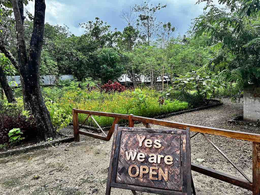
You can eat there without staying, provided you book ahead — that reservation is the part people get wrong, because the kitchen is a teaching kitchen and it is not set up for walk-ins. The evening I went, the meal was excellent. Paying for dinner there also contributes directly to the training of young Sumbanese, which is a rare case of the ethical option and the good option being the same option.
North and west of Tambolaka lie the three sites that appear most often in images of Sumba, and which I am describing here from the map rather than from experience. Weekuri Lagoon is a saltwater lagoon separated from the ocean by a rock barrier, filled by the sea through fissures in the rock, which is why its water is calm and turquoise while the ocean beyond it is not. Mandorak is a small cove enclosed by rock outcrops, a short distance from the lagoon and usually visited on the same run. Ratenggaro is a coastal traditional village known for having the tallest tower roofs on the island and for its stone tombs standing on the sand near the shore. All three are on the standard northwest day trip out of Tambolaka, and all three involve rough final approaches; the same 4×4 logic applies.
Sumba Culture: Marapu, Ikat, the Parang and the Uma Mbatangu
Sumba is one of the few places in Indonesia where the pre-Islamic, pre-Christian belief system is not a historical footnote but an active organising principle. Understanding the basics of it before you arrive changes what you see on the ground, because almost every visible feature of a Sumbanese village — where the houses face, why the tombs are where they are, when things happen — follows from it.
Marapu, the ancestral religion
Marapu is the ancestral religion of Sumba, and it is still practised. Its central principle is the continuing relationship between the living and their ancestors, who remain participants in the affairs of the household and the clan rather than departed figures to be remembered. That single idea explains most of what a visitor notices. It explains the megalithic tombs placed in the middle of the village, at the doorstep rather than in a cemetery on the outskirts — the dead stay in the settlement because they are still part of it. It explains the orientation and internal layout of the houses, which are organised around ritual as much as around domestic convenience. And it explains the ritual calendar, which sets when ceremonies, sacrifices and agricultural work take place.
Christianity is widespread on the island today, and in many communities the two coexist rather than compete, with Marapu obligations continuing alongside church attendance. For a visitor, the practical consequence is simple: a village is a ritual space as well as a residential one. Ask before entering, ask before photographing, ask before touching a tomb, and accept a refusal without negotiating.
The uma mbatangu and the two doors
The uma mbatangu — the peaked house — is the architectural signature of the island and one of the most distinctive traditional structures in Indonesia. The tall, sharp central tower rising over the hearth is a chimney and a thermal engine: it draws the hot air and smoke up and out of the living space below, which is what makes a thatched house habitable in this climate. The peaks of the west are higher and more pointed than those of the east, and the difference is visible from the road.
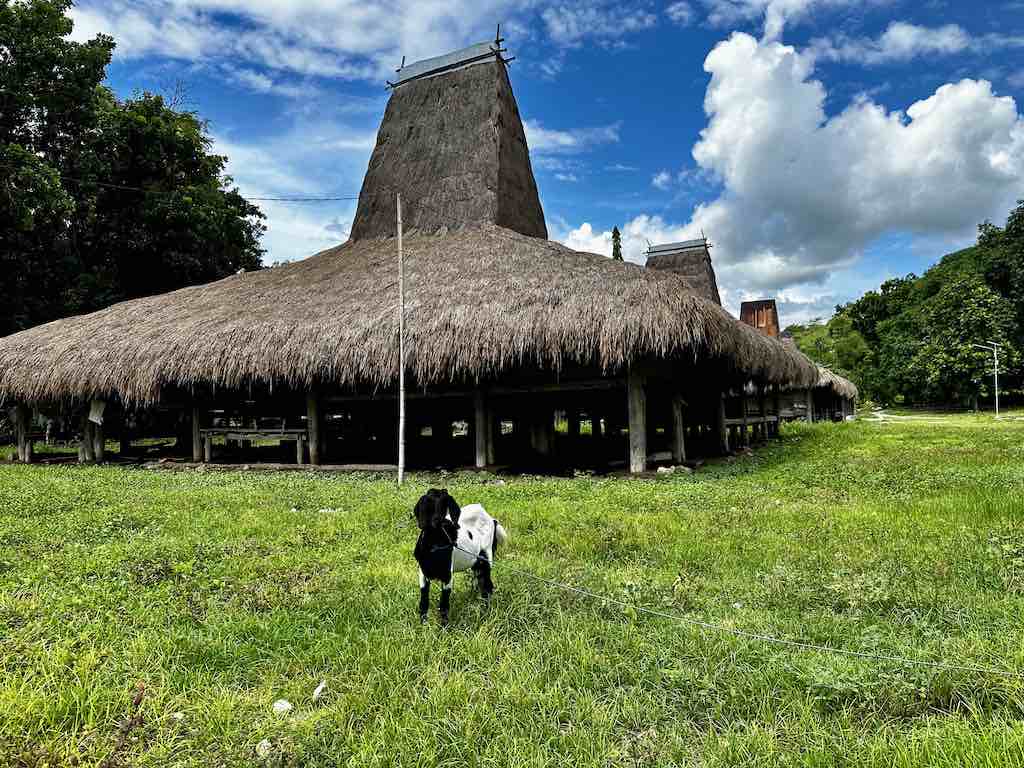
The two doors are the rule to memorise. The left-hand entrance belongs to the family; the right-hand one is for visitors. Use the right one, wait to be invited in, and remove your shoes as you would anywhere else in Indonesia. Bringing something — betel nut, coffee, sugar, or simply buying a textile before you leave — is the normal way of acknowledging that a household has just given you its morning.
Ikat is the island’s other great craft, and on Sumba it is not abstract decoration. The threads are dyed with plants and roots before weaving, in a resist process that has to anticipate the finished pattern, and the motifs — horses, skull trees, human figures, buffalo — carry meaning tied to status and to the ancestors. That is why a Sumbanese cloth is not simply a nice textile: historically it was funerary and ceremonial equipment as much as clothing.
Then there is the parang, the traditional machete that a great many Sumbanese men carry on the hip. Its first use is entirely practical — it cuts vegetation, and on an island this overgrown that is a daily necessity. But it also carries a symbolic and cultural charge that goes well beyond the tool, which is why you see it worn in contexts where nothing needs cutting. It is, incidentally, a running joke between the two halves of the island: people in East Sumba will happily tease their western neighbours about their parang, and they do not need much encouragement to start. Take it for what it is — teasing between regions, of the kind every country has.
Pasola: Sumba’s Spear-Throwing Ritual
Pasola is the ritual that makes Sumba famous outside Indonesia, and it belongs to the west of the island. Mounted horsemen from two opposing clans charge each other across an open field and throw blunted wooden spears, in a ritual combat that is neither a re-enactment nor a show. It is a religious event within the Marapu system, tied to the agricultural calendar, and it is held for the community rather than for an audience.
The underlying logic is fertility. Blood spilled on the ground during Pasola is understood to fertilise the earth and to secure the coming harvest, which is why the event sits where it does in the year — at the hinge between the rains and the growing season. That also explains why it cannot simply be scheduled: the trigger is the arrival of the nyale, the sea worms that appear on the shoreline on certain nights. Ritual specialists watch for them, and the fighting follows.
When and where Pasola takes place
Pasola is not a single date but a season, spread over several weeks between February and March, with different villages holding their own event at different moments. The names that recur are Lamboya, Wanukaka, Kodi and Gaura, each with its own timing within that window. Broadly, the earlier events fall in February and the later ones in March, but the order and the exact days shift from year to year.
This is the part to plan around honestly: the dates are only fixed a few days in advance, because they depend on the nyale. There is no reliable calendar published months ahead, and any date you find online a season early should be treated as an estimate rather than a booking basis. The only workable approach is to be on the island during the February–March window, ask locally — through your accommodation, a driver, or the local authorities — and be ready to move on short notice. If you build a rigid itinerary around a Pasola date found in advance, you will very likely miss it.
Two further points. Pasola takes place in the rainy season, which is also when the roads are at their worst, so a spear-throwing trip and a comfortable driving trip are not the same trip. And it remains a genuine ritual combat: injuries occur, and spectators stand where they are told to stand. Attend as a guest of the community, follow the instructions you are given, and keep the drone in the bag unless you have been explicitly told otherwise.
How Many Days, and a Suggested Itinerary
Sumba punishes short trips. The flights are infrequent, the drives are long, and the single most common mistake is to allocate three or four days and then spend most of them in a vehicle. Seven to ten days is the right range for the east-to-west crossing, landing at Waingapu and flying out of Tambolaka. Five days is the absolute floor and forces you to cut either Tarimbang or the northwest. If you only have three or four days, pick one half of the island, fly in and out of the same airport, and do it properly rather than crossing badly.
An eight-day east-to-west route
Day 1 — Waingapu. Fly in from Bali, take the hotel shuttle, and do nothing else. The single daily flight and the transfer will absorb the day. Sunset from the hill above the river is a good use of the remaining light.
Day 2 — the hills and Walakiri. The 5:30 AM walk in the hills, back by 7:00 AM, then a slow day: Walakiri in the late afternoon for the trees in the water. This is your acclimatisation day and you will want it.
Day 3 — Melolo, Watu Hadang, Praiyawang. A full day southeast: the traditional village and its thatched houses, the dyeing demonstration, the royal tombs at Kampung Adat Praiyawang, a look at the Kayouri river mouth. Lunch or dinner at Amu Dahi.
Day 4 — Tarimbang. Leave early and write off the day for driving. Three hours for the last stretch alone, worse if you come via Melolo. Arrive, walk the empty beach, sleep on the coast.
Day 5 — Tarimbang to Waikabubak. A morning on the bay, then the long transfer west. You will arrive tired; plan nothing for the evening beyond dinner.
Day 6 — Wailang and the Waikabubak market. The market first thing, while the produce and the ikat are both out, then the traditional village of Wailang. Compare the roof peaks with what you saw in the east.
Day 7 — the southwest coast. Move to the coast, surf or walk depending on your level and the swell, and watch the sunset from the bay. Two nights here if you can spare them.
Day 8 — Tambolaka. The Talasi cashew factory in the morning, the northwest sites if you have the day, dinner booked ahead at the Sumba Hospitality Foundation, and out from Tambolaka the following morning.
Two adjustments worth making. If you are travelling in February or March, build slack into the middle of the trip so you can chase a Pasola date announced at short notice. And if you are combining Sumba with another island, the obvious pairing is Flores, which shares the same regional airline network and offers a completely different landscape — volcanoes, crater lakes and the boats out of Labuan Bajo to Komodo.
Where to Stay in Sumba
Accommodation is the first budget line on Sumba and the one that constrains your itinerary the most. Outside Waingapu, Waikabubak, Tambolaka and the southwest coast, the choice thins out fast, and in the low season some places simply do not open. Book ahead, particularly for Tarimbang and for anywhere on the southwestern beaches, and do not assume you will find something on arrival the way you would on Bali.
The addresses I actually used
Morinda Villa and Resto, Waingapu. Fifteen minutes south of the airport, with a free shuttle, set on a hill above a river and surrounded by very green hills. This is where I stayed on arrival and where the 5:30 AM hill walk starts. Sunrise and sunset from the property are the two moments that justify the location. It is also the practical choice for anyone flying in late on the single daily flight, because the transfer is short and organised.
Sumba Surf Camp, southwest coast. I spent two nights here, in the same bay as Nihi, at a far more affordable price. It is not listed on the usual booking platforms, so go through their own site or ask your driver to call ahead. It is the answer for people who want the southwest coast without the southwest coast’s headline rate.
NIHI Sumba, southwest coast. The famous one, listed under the 50 Best Hotels of the World, and the property that put Sumba on the international map in the first place. It occupies the same bay as the surf camp, at an entirely different level of service and price. I did not stay there, so I will not review it — but it is worth knowing that the bay itself is not private, and that the sunset over that water is the same whichever side of the fence you are on.
Maringi Sumba by the Sumba Hospitality Foundation, west Sumba. The eco-resort attached to the hospitality school. Staying or eating here funds a year of training for students recruited from schools across the island, and the service is delivered by those students under supervision. Book dinner in advance if you are not sleeping there. The evening I ate at the foundation, the meal was excellent.
Beyond those, Amu Dahi in the east works for a meal or a night if you would rather break the drive south than double back to Waingapu, and Tarimbang has a small number of discreet eco-resorts oriented towards surfers and spearfishermen. In the towns, expect simple guesthouses rather than hotels, and expect the internet to be slow enough that you should download your maps before leaving Bali.
Getting to Sumba and Getting Around
Sumba has two airports, Waingapu in the east and Tambolaka in the west, and both are served from Bali by the regional carriers that cover eastern Indonesia. The frequency is the thing to plan around. Before Covid there were four flights a day between Bali and Waingapu; today there is one. The schedule has not been rebuilt, so a cancelled or shifted flight has no same-day fallback, and you should not put a tight international connection on the other end of a Sumba departure. Leave a night in Bali as a buffer.
Book the open-jaw — into Waingapu, out of Tambolaka — as two separate one-way tickets if the airline does not sell it as a pair. Backtracking across the island to return to your arrival airport costs you a full day of driving for nothing. You can compare regional connections and buy tickets through 12Go, which aggregates flights, ferries and buses across the archipelago, and the broader mechanics of moving between islands are covered in the guide to getting around Indonesia.
Renting a 4×4 with a driver
There is no realistic way to see Sumba without a car, and there is no good reason to drive it yourself. The vehicle you want is a 4×4 with a driver. Roads outside the main axes vary from mediocre to genuinely bad, signage is minimal, villages require an introduction, and a local driver solves all three problems at once while also knowing which river you should not swim in.
Arrange it on the spot or, more simply, through your accommodation — hotels in Waingapu and Tambolaka do this routinely and will match you with someone they work with regularly. Budget roughly double what the equivalent day costs in Bali or on Nusa Penida; the island is bigger, the fuel is further away, and the wear on a vehicle here is not comparable. Agree the itinerary and the daily rate before you set off, confirm whether fuel and the driver’s meals are included, and be explicit that you intend to go to Tarimbang if you do — that stretch changes what a driver is willing to accept.
Scooters exist and are fine for short hops around Waingapu, Waikabubak or a beach, but they are not a way to cross the island with luggage. Public transport, in the form of bemos and small buses, connects the main towns on the main road and is slow, cheap and not adapted to a village-and-beach itinerary. There is no ride-hailing coverage worth relying on outside the towns, and mobile signal disappears for long stretches — download offline maps before you leave.
Best Time to Visit Sumba
The dry season runs roughly from April to October and the rains roughly from November to March, and the two produce genuinely different islands. In the dry months the roads are firmer and faster, the sea is calmer for beach days, and the east turns brown — wide, dusty savanna with horses on it, which is its classic look. In the wet months the driving gets harder and the same eastern hills turn a green so intense it stops looking real. I crossed in March and got the green version, and I do not regret it, but I paid for it in road time.
If your priority is comfortable travel and reliable beach weather, aim for the middle of the dry season. If your priority is landscape photography, the end of the rains — around March — gives you the greenest hills and the most dramatic skies, at the cost of slower going. And if your priority is Pasola, you have no choice at all: February and March, in the west, with a flexible schedule.
Two practical notes on timing. Sumba does not have a tourist high season in the way Bali does, so crowding is not a factor in choosing your dates — flight availability is. And the school and holiday peaks in Indonesia affect the Bali–Sumba flight more than they affect anything on the island itself, so book that leg as early as you can. For everything upstream of the island — visas, entry, the best months across the archipelago as a whole — the Indonesia guide is the place to start.
Read More About Indonesia
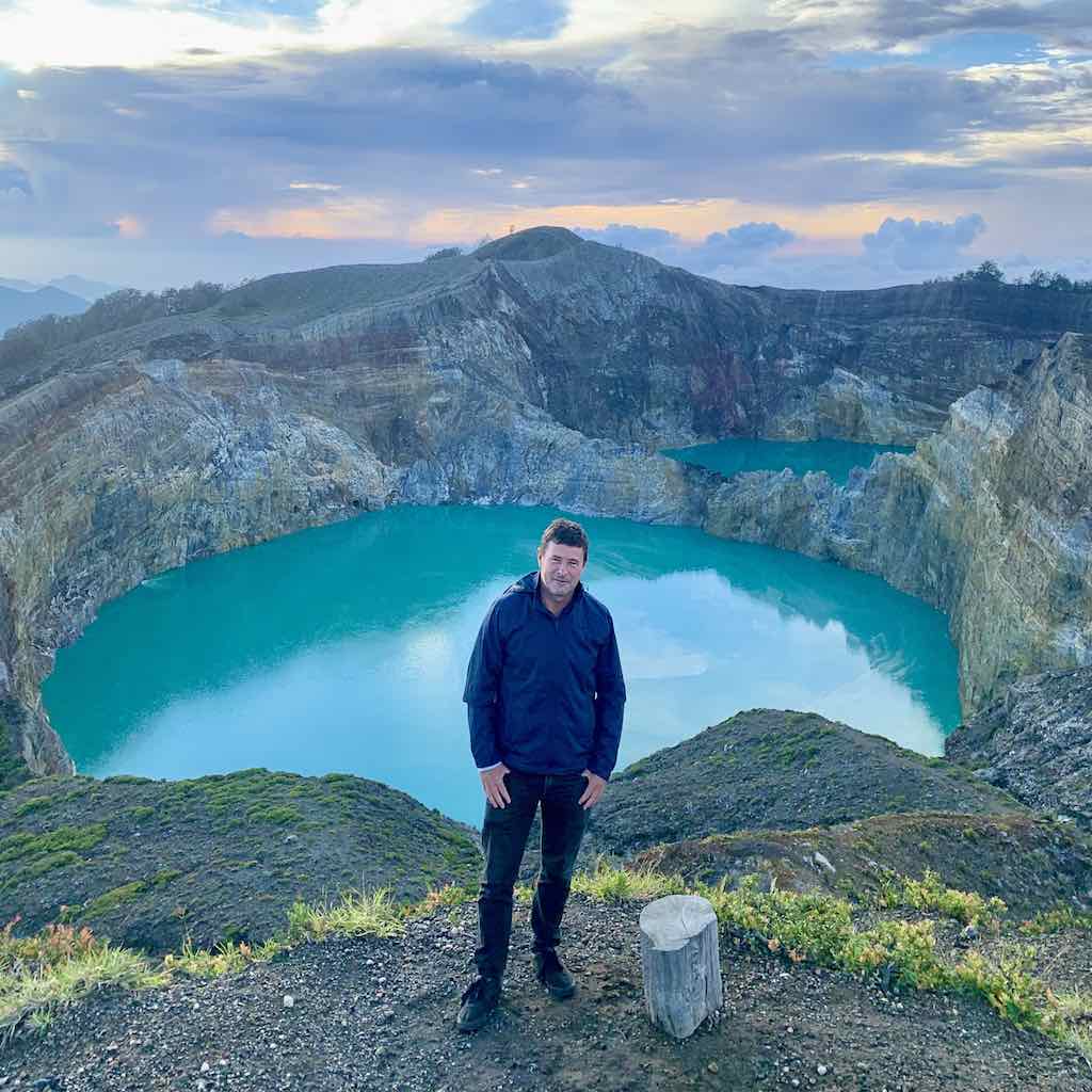
Flores
Sumba’s natural companion island: volcanoes, the coloured crater lakes of Kelimutu, and traditional villages of a completely different kind. Read the Flores guide.
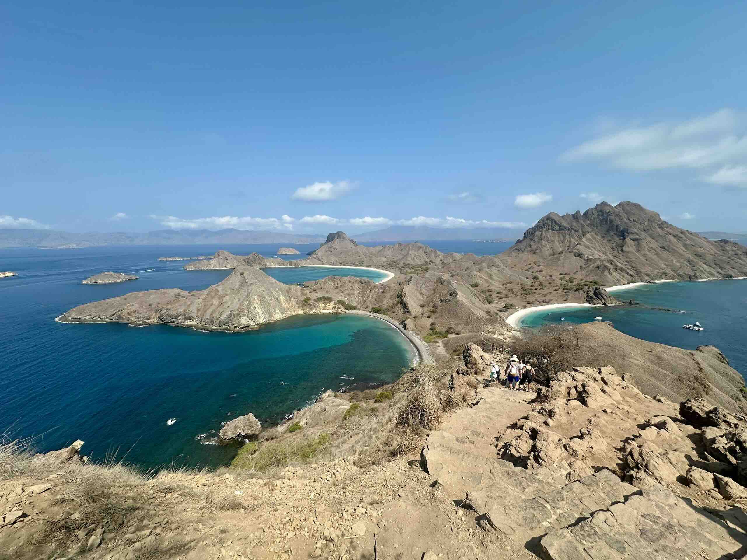
Labuan Bajo & Komodo
The boats, the dragons and the viewpoints of Padar, at the western tip of Flores. Read the Labuan Bajo and Komodo guide.
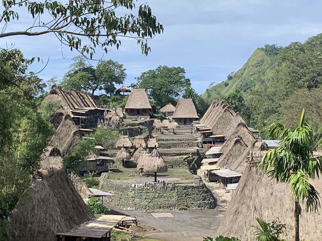
All of Indonesia
Islands, itineraries and practical planning across the archipelago, from Bali to the far east. Read the Indonesia guide.
Frequently Asked Questions About Sumba
Where is Sumba?
Sumba is an island in East Nusa Tenggara province, in eastern Indonesia. It lies in the Lesser Sunda chain, south of Flores and south-east of Sumbawa, and it is reached by air from Bali. It is a separate island from Sumbawa and from Flores, despite the similar-sounding name, and it has two airports of its own: Waingapu in the east and Tambolaka in the west.
Is Sumba worth visiting?
Yes, if you accept that it is a demanding island rather than a relaxing one. Sumba offers a living ancestral culture, megalithic tombs standing in inhabited villages, empty surf beaches and landscapes that swing from savanna to jungle across a single drive. What it does not offer is easy transport, dense accommodation or nightlife. Travellers who enjoyed the harder parts of Flores or Sumbawa will get a lot out of it; travellers who want a beach holiday will not.
How do you get to Sumba?
By plane from Bali, to either Waingapu or Tambolaka. There is currently one daily flight to Waingapu, against four a day before Covid, so the schedule dictates your dates rather than the reverse. The best plan is an open-jaw: fly into Waingapu, cross the island, fly out of Tambolaka. Leave a buffer night in Bali before any international connection.
How many days do you need in Sumba?
Seven to ten days for a full east-to-west crossing. Five days is the minimum that still makes sense and forces you to drop either Tarimbang or the northwest. With three or four days, stay in one half of the island and fly in and out of the same airport — the drives are long enough that a rushed crossing becomes a car trip with occasional stops.
What is the best time to visit Sumba?
The dry season, roughly April to October, for the easiest roads and the calmest sea. The end of the rains, around March, for the greenest landscapes and the most dramatic skies, at the cost of much slower driving. February and March if you want Pasola. There is no crowding problem to plan around on Sumba; flight availability is the real constraint.
What is Pasola?
Pasola is a ritual spear-throwing contest held in western Sumba, in which mounted horsemen from two clans charge each other and throw blunted spears. It belongs to the Marapu religion and to the agricultural calendar, and the blood spilled is believed to fertilise the land. It is triggered by the arrival of the nyale sea worms on the coast and takes place over several weeks between February and March, in villages including Lamboya, Wanukaka, Kodi and Gaura. Dates are only confirmed a few days ahead, so you have to ask locally once you are on the island.
Do you need a 4×4 in Sumba?
For anything beyond the main road between the towns, yes. The last stretch into Tarimbang took me around three hours in a 4×4, and the approach from Melolo is worse. One Belgian traveller left at 7:00 AM in an ordinary car and arrived at midnight. Hire a 4×4 with a driver, arranged on the spot or through your accommodation, and expect to pay roughly double the equivalent day rate in Bali or Nusa Penida.
Is Sumba safe for travellers?
Sumba is a calm island and the main risks are practical rather than criminal. The roads are the first one: long drives, poor surfaces, and no reason to be on them after dark. The second is water — the south coast has heavy swell and no lifeguards, and river mouths such as Kayouri are crocodile habitat, so you swim in the sea and only where locals tell you it is fine. Medical facilities are basic outside the main towns, mobile coverage is patchy, and travel insurance that covers evacuation is a sensible precaution.
What is Sumba known for?
Four things above all: the Marapu ancestral religion and the megalithic tombs that come with it; the uma mbatangu, the peaked thatched houses with their tall central towers; hand-woven ikat textiles; and Pasola, the spear-throwing ritual. To that list most visitors add the empty surf beaches of the south and southwest, and the wild horses of the eastern savanna.
Sumba or Bali — which should you choose?
They are not competitors. Bali has infrastructure, choice, food and easy transport; Sumba has emptiness, living tradition and difficult roads. Sumba is about twice the size of Bali with roughly a fifth of the population density, and it has nothing resembling Bali’s tourism machine. Most people are better served by treating Sumba as an addition to an Indonesian trip rather than as a replacement for Bali — arrive via Bali, spend a week on Sumba, and go back through Bali on the way out.
Where should you stay in Sumba?
Split your nights between the two halves. In the east, Morinda Villa and Resto near Waingapu is a practical and beautiful base, fifteen minutes from the airport with a free shuttle. On the southwest coast you have the whole range, from the Sumba Surf Camp to NIHI Sumba in the same bay. In the west, Maringi Sumba by the Sumba Hospitality Foundation combines an eco-resort with a hospitality school. Book everything in advance — outside those areas the choice is very thin.